

Preview
Caption
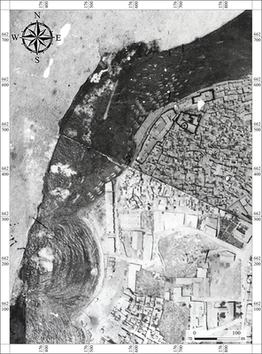
8. Map of Yafo Harbor and the area of Birket al-Qamar, showing the sand-trapping wall extension, based on a 1924 aerial photograph (Survey of Israel).
כיתוב
8. מפה של נמל יפו ואזור ברכת אל-קמר, על בסיס תצלום אוויר משנת 1924. (המרכז למיפוי ישראל)
Permit/License Number - מספר הרשאה/רישיון
A-8993