Tel Yavne (West) (A-5612)
Permit/License Number
A-5612
Excavation Report
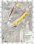
During February–April 2009, a salvage excavation was conducted on Ha-‘Aẓma‘ut Boulevard in Yavne, west of Tel Yavne (Permit No. A-5612; map ref. 175795–6097/641194–844; Fig. 1), in preparation for the widening and infrastructure improvements of the street. The excavation, on behalf of the Israel Antiquities Authority and funded by the Yavne Municipality, was directed by U. ‘Ad, with the assistance of P. Gendelman and C. Ben-Ari (areas supervision), D. Golan, E. Jakoel and M. Mullokandov (area preparation), S. Ya‘aqov-Jam, E. Bachar and R. Abu Halaf (administration), V. Essman and M. Kipnis (surveying and drafting), A. Peretz (field photography), A. Dagot (GPS), Y. Gomani (location map), Sky View Company (aerial photography), S. al-‘Amlah (metal detector), E. Kamaisky (pottery restoration) and IAA Tel Aviv District inspectors.
Tel Yavne (c. 150 dunam) extends near the ancient Sea Road and is one of the largest and most important tels in the southern coastal plane. On the northwestern slope of the tel, east of the excavation area, the kurkar rock is exposed. The southwestern slope of the tel is occupied by the remains of an Arab village from the Ottoman period and the British Mandate era.
Only one limited excavation (License No. G-56/2005) has been conducted on the upper part of the tel. Around the tel, numerous excavations took place, and remains of buildings, industrial installations, tombs and caves from the Chalcolithic period to modern times were uncovered (Kletter 2004 [Fig. 1:1]; Yannai 2014 [Fig. 1:2]; Nadav-Ziv et al. 2022 [Fig. 1: A-8520, A-8656]; Kelman, Betzer and Varga 2025 [Fig. 1: A-8999], and see further references there; Permit No. A-8061 [Fig. 1:3]). Three excavations were conducted to the west and east of the present excavation (Volynsky 2009 [Fig. 1:6]; Feldstein and Shmueli 2011 [Fig. 1:4]; Feldstein and ‘Ad 2014 [Fig. 1:5]), and building remains from the Byzantine, Early Islamic, Mamluk and Ottoman periods as well as from the British Mandate era to the 1960s were found; one of the buildings discovered is an industrial building with two Byzantine-period glass kilns (for additional information see Taxel 2005; Haddad et al. 2022).
Approximately 50 excavation squares were opened in six areas arranged in a narrow strip (A–F; length c. 700 m; width 3–6 m); Area A is the northernmost, followed in order to the south, until Area F at the southern end. Remains of ten occupation strata (X–I; Table 1) were uncovered, but not all of them were found in all areas. Foundations of buildings from the Ottoman period to the 1960s were found near the surface. Below them were remains of buildings and installations from the Early Islamic period that were built over an industrial area on the western fringe of a Roman and Byzantine-period settlement. In most cases, the narrow extent of the excavation area did not allow for the exposure of complete assemblages, buildings and installations. A modern road near the tel and many pits that were dug in the area from the Ottoman period and onwards made it difficult to date some of the assemblages that were found close to the surface. In some squares, the excavation went down to a depth of more than c. 3 m, without reaching sterile soil or the bedrock (the excavation was stopped because of safety concerns).
Area A (Fig. 2)
Remains of buildings, some built on top of each other, were uncovered and attributed to several strata; the date of the earliest stratum is unknown, but the strata above it (VI–I) are dated from the Byzantine period to the present day.
The Early Stratum (Fig. 2: marked in red). In the central part of the area, a corner of a massive building with thick walls of small fieldstones was uncovered. Due to later disturbances, it was impossible to date this stratum, but stratigraphically it is the earliest.
Stratum VI (Fig. 2: marked in blue). Above the early-stratum building, another building was erected, from which a wall and a robber trench of another wall survived (marked with a dashed line). The wall’s foundations (depth over 1.5 m) were built of dressed stones and fieldstones, most of them resting on the bedrock, and a few on the wall of the previous stratum. In the southwestern part of the wall, an entryway was found (width c. 1.8 m; marked with an arrow) and in it a threshold. East of the threshold and the northern end of the wall, remains of a floor bedding were found. Habitation levels and additional floor remains from this stratum were also uncovered in the southern end of the area. Judging by the construction method and the entrance width, this wall was part of a public building. According to the pottery assemblage in the habitation levels and near the foundations of the walls, it seems that the building was constructed and used from the end of the Byzantine period to the beginning of the Umayyad period.
Stratum V (Fig. 2: marked in orange). In the northeastern part of the area, foundations of a wall were exposed, preserved to a height of one course, and to the northwest of them was a layer of stones. The wall was built over the Stratum VI floor bedding.
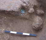
Stratum IV (Fig. 2: marked in purple). Above the remains of the Stratum VI wall, meager remains of a wall built of stones that were robbed from the walls and floors of the earlier strata were found. Southeast of the wall, floors of small and medium fieldstones were laid. Most of the foundation stones and the walls of Stratum IV were robbed, but it is impossible to know when. At the bottom of one of the robber trenches and above the remains of the wall’s foundations, there was a hoard of 53 coins, including three silver coins (Fig. 3), dating to the end of the twelfth century CE (Kool and ‘Ad 2016).
Strata II and I (Fig. 2: marked in yellow). Remains of several walls and floors were discovered close to the surface. The finds indicate that these are remains from the Ottoman period that were used, with few changes, until the 1960s.
Area B (Fig. 4)
Eleven squares were opened, and remains of buildings, some extensive, as well as a range of installations, all dated from the Late Roman period to modern times, were uncovered (Strata VIII, V–I).
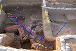
Stratum VIII (Fig. 5: marked in red). In the northern part of the area, a fieldstone wall was uncovered. North of the wall, at approximately the same level, a number of large stone slabs, which were probably remnants of a stone floor, were exposed; it was not possible to clarify if the floor abutted the wall because of a later wall that was built above it (Stratum IV, see below). South of the wall, in the center of the area, four kurkar ashlars, which functioned as pillars or bases of columns, were found.
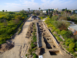
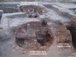
Stratum V (Fig. 5: marked in purple). A packed-earth floor with burnt matter above it was exposed above the Stratum VIII wall and in other places in the northern part of the area. Three pits were dug into the floor, and bases of Gaza Ware jars were placed in them. Three pottery kilns dated to the second half of the seventh century CE were found in the southern part of the area (Fig. 6). The combustion chambers of the two northern kilns (diam. c. 3 m, preserved height 2.5 m) were nearly completely exposed. The third kiln is slightly earlier, but it was mostly destroyed when the northwestern kiln was established, and only its southern part survived. Refuse pits were uncovered next to the kilns.
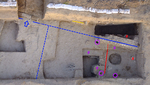
Stratum IV (Fig. 5: marked in blue). Two buildings (northern and southern) extending over a very large area were built above Strata VIII and V. A remnant of a wall with a threshold (Fig. 5: marked with a blue arrow) belonging to the northern building survived. The remaining walls are represented only by robber trenches (Fig. 5: marked with dashed blue line). The remains of the northern building indicate that there were three large rectangular rooms. The southern building was uncovered in the central part of Area B (not on the photograph), north of the Stratum V kilns, and its remains were comprised of an entryway with a threshold in the eastern wall and an installation paved with fired bricks, perhaps a ṭabun. The building’s walls were oriented differently than those of the northern building. The building’s floors were made of light colored and well packed material.
Stratum III. Above the foundations of the southern building, meager remains of walls built of stones that were robbed from Stratum IV were found; they delineated rooms. These rooms were filled with small and medium-sized fieldstones, and the top of the fill was leveled to form stone surfaces. The stone surfaces abutted from the south an installation that was built in the southern room of the northern building, which remained in use in this stratum; the sides of the installation were plastered with white hydraulic plaster, and it therefore seems that the installation was used as a pool. Later, when the building and the installation went out of use, most of the stones from the foundations and walls were robbed.
Strata II and I (Fig. 5: marked in yellow). Remains of walls and pits filled with refuse and stones were found in the top stratum that was exposed close to the surface all over Area B. The finds suggest that these were remains of Ottoman-period buildings, which were used, with modifications, until the 1960s (Stratum I).
Area C (Fig. 7)
Six squares were opened, uncovering caves or pits hewn into kurkar, with buildings above them dated from the Umayyad period to modern times.
Stratum VI. A cistern hewn in the rock in the eastern part of the area was filled with accumulated crumbling earth containing four standing Gaza Ware jars (Fig. 8), dated to the sixth–seventh centuries CE, and large quantities of Roman-period finds. The pit may have been part of a cave whose roof collapsed or was removed.
Stratum V(?). In the center of this area, a corner of a building constructed of hewn stones, probably dating to the Umayyad period, was uncovered. It was severely damaged by Abbasid-period pits and Ottoman-period buildings that were constructed above it.
Strata II and I. In the top stratum, directly below the surface, a large building comprised of four or five rooms and dated from the Ottoman period–British Mandate era, was uncovered. The walls and floors of the rooms were constructed of medium and small fieldstones.
Area D
This area extends between the tel and the area of Feldstein and Shmueli’s excavation (see Fig. 1:4), and eight excavation squares were opened. Building remains from the end of the Byzantine–beginning of the Umayyad periods (Stratum VI) and finds from the Ottoman period (Stratum II) were uncovered.
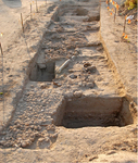
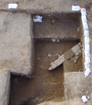
Stratum VI. In the southern part of the area, at a depth of 1.5 m and more below the surface, a wall constructed from ashlars and large fieldstones (Fig. 9) and a segment of a stone floor that abuts the wall from the west, were uncovered. A robber trench was uncovered north of the wall, indicating that it probably continued towards the north. These remains were dated to the end of the Byzantine–beginning of the Umayyad periods. They were severely damaged between the Ottoman period and the 1960s by excavations of pits and trenches and by road construction.
Stratum II. An accumulation of soil was found above the remains of Stratum VI construction, and in it were finds predominantly from the Ottoman period.
In the squares north of the wall, remains of two or three walls were uncovered, with floor segments made of small stones between them. They are poorly preserved because of the proximity to the surface and later damage, and they could not be dated.
Area E
Five squares were partially excavated, uncovering architectural remains and finds predominantly attributed to three strata (X, IX, II).
Stratum X (Fig. 10: marked in black). Early Roman-period floors (end first century BCE–beginning first century CE) were exposed.
Stratum IX (Fig. 10: marked in turquoise). Remains of a building (exposed surface 5 × 7 m) from the Late Roman period (third–fourth centuries CE) were uncovered, comprising two cast debesh walls that form a corner, abutted by a floor laid on the bedrock. The walls and floor were plastered with high-quality plaster. Above the floor and north of the building, many small columns made of fired bricks and mortar indicate that the building was a caldarium in a bathhouse.
Stratum II. Thirty-five meters southwest of the Stratum IX building, remains of an Ottoman-period building that continued beyond the excavation’s boundaries were uncovered. An accumulation of earth (depth 2.5 m) was found above the Stratum IX building, and it contained finds from the Ottoman period to recent times.
Area F
The area extends west of the Feldstein and ‘Ad excavation area (see Fig. 1:5) and east of the Feldstein and Shmueli excavation area (see Fig. 1:4), and remains of two strata (VI, II–I) were found.
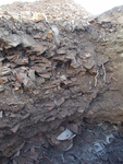
Stratum VI. Habitation levels from the end of the Byzantine–beginning of the Umayyad periods (sixth–seventh centuries CE) were uncovered in the western part of the area. In the eastern part, large and deep refuse pits (diam. over 7 m, depth of some over 2.5 m), which contained numerous pottery fragments (Fig. 11), including Gaza Ware jars, cooking pots and oil lamps, some nearly complete, also date to the sixth–seventh centuries CE.
Strata II and I. Above the habitation levels and the refuse pits and below the surface, remains of walls and floors of a building with four or five rooms were uncovered. According to the finds, the building was probably built during the Ottoman period and remained in use until the 1960s with few modifications, such as thickening the walls and raising the floors.
Conclusion
The limited width of the excavation areas and the later damage inflicted in the area prevented in most cases identification of the full plan of the buildings and installations that were uncovered and their functions. On the other hand, the considerable length of the strip created a cross-section of along the entire western edge of Tel Yavne, which enhances our understanding of the activity in this area. Combining the finds from the present excavation with those of previous ones in the area will generate a fuller picture of the activity around the tel.
The excavation uncovered few remains from the Early and Late Roman periods, suggesting little activity in this area during these periods; alternatively, the excavation did not reach deep enough to expose these assemblages. In contrast, there was massive activity during the Byzantine and the beginning of the Early Islamic periods (Kletter 2004; Feldstein and Shmueli 2011). Extensive buildings and installations were uncovered in the northern and central parts of the area, including pottery kilns and installations related to activity with liquids. The southern part of the area was apparently used to discard refuse. The few remains and finds, including a hoard of coins, that were found from the Abbasid, Fatimid, Crusader and Mamluk periods, attest to sparse occupation of this area (Volynsky 2009). In the Ottoman period, the settlement on the tel expanded and reached its edge and even areas south and west of the tel (Nadav-Ziv et al. 2022: Fig. 15).
References
Feldstein A. and ‘Ad U. 2014. Tel Yavne, Southwestern Slope. HA-ESI 126. https://doi.org/10.69704/jhaesi.116.2004.13707
Feldstein A. and Shmueli O. 2011. Tel Yavne. HA-ESI 123. https://doi.org/10.69704/jhaesi.116.2004.1735
Haddad E., Nadav-Ziv L., Seligman J., Varga D., Betzer P., Shadman A., Tal O. and Tepper Y. eds. 2022. Yavne and Its Secrets: Collected Papers. Jerusalem
Kelman I., Betzer P. and Varga D. 2025. Tel Yavne, Area Q. HA-ESI 137. https://doi.org/10.69704/jhaesi.116.2004.27727
Kletter R. 2004. Tel Yavne. HA-ESI 116. https://doi.org/10.69704/jhaesi.116.2004.30
Kool R. and ‘Ad U. 2016. A Late Twelfth-Century Silver Purse from Ibelin. INR 11:163–180.
Nadav-Ziv L., Haddad E., Seligman J., Varga D. and Betzer P. 2022. Ancient Yavne: Preliminary Finds from the Extensive Excavations at the Foot of Tel Yavne. In E. Haddad, L. Nadav-Ziv, J. Seligman, D. Varga, P. Betzer, A. Shadman, O. Tal and Y. Tepper eds. 2022. Yavne and Its Secrets: Collected Papers. Pp. 19–53 (Hebrew). Jerusalem.
Taxel I. 2005. Yavne: History and Archaeology. In M. Fisher ed. Yavne, Yavne Yam and their Environs. Tel Aviv. Pp. 139–170 (Hebrew).
Volynsky F. 2009. Tel Yavne. HA-ESI 121. https://doi.org/10.69704/jhaesi.116.2004.1110
Yannai E. 2014. Yavne. HA-ESI 126. https://doi.org/10.69704/jhaesi.116.2004.13677
Keywords
Ancient Sea Road, Roman period, Byzantine period, Early Islamic period, Umayyad period, Abbasid period, Ottoman period, British Mandate, buildings remains, ashlars, pottery kilns, plastered installation, refuse pits, bathhouse
Publication Date
04/08/2026
Report Type
Preliminary Report