Giv‘at Ziqit (A-5403)
Permit/License Number
A-5403
Excavation Report
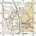
During April–May 2008, an excavation was conducted at Giv‘at Ziqit, east of Moshav Sheqef (Permit No. A-5403; map ref. 194463/602940; Fig. 1), prior to paving Road 358. The excavation, on behalf of the Israel Antiquities Authority and funded by Netivei Israel National Transport Infrastructure Company, was directed by Y. Baumgarten and N.S. Paran (field photography), with the assistance of M. Ein Gedi (area supervision), Y. Lender (administration), D. Levi (GIS/GPS), M. Volok (recording). T. Sagiv (field photography), Sky View Company (aerial photography), V. Essman and M. Kunin (surveying and drafting), E. Belashov and D. Porotsky (plans), D. Gazit (studio photography), Y. Paz and S. Mizrahi (pottery finds), A. Ganor (pottery restoration), I. Lidsky-Reznikov (pottery drawing), A. Karasik and A. Gyerman-Levanon (digital documentation), I. Naor (metal laboratory), M. Shemer (flint tools), L. Zeiger (flint tools drawing), Y. Abadi-Reiss (stone tools), Y. Nagar (physical anthropology), Z. Turgeman-Yaffe (animal bones) and E. Boaretto (radiocarbon dating).
Giv‘at Ziqit (Rasm ez-Za‘iqa) is located south of a Naḥal Lakhish tributary and about 12 km southeast of Tel Lakhish. The hill is characterized by a cover layer of hard and fissured limestone over a layer of soft limestone. Settlement remains (c. 35 dunam) from the Early Bronze Age II–III, the Intermediate Bronze Age, the Iron Age IIB and the Hellenistic, Roman and Byzantine periods were first identified on the hill while surveying the area around Amaẓya (Dagan 2006: Site 547). The pottery that was collected from Giv‘at Ziqit during the survey was reevaluated as part of a study on settlement hierarchy during the Early Bronze Age (Levy-Reifer 2004:210–211, Site 178); this led to a suggestion that a town existed on the hill during the Early Bronze Age III. Caves used during the Early Bronze Age III were found in 1991 during an excavation on the hillslope about 20 m north of the present excavation (Y. Baumgarten, pers. comm. [Fig. 1: A-3077]).
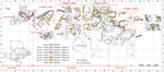
In the current excavation, 62 squares (147 sq m) were opened and divided into three areas (A–C; Fig. 2). Remains of a village with architectural complexes and hewn caves, which were used as dwellings and for agricultural activity, were found; four settlement strata were identified (1–4). Stratum 1 was dated to an earlier stage of the Early Bronze Age IB, which is contemporary with Stratum C at Tel ‘Erani (Yekutieli 2000; 2006). Stratum 2 was dated to a later stage of the Early Bronze Age IB (for background on this period, see Yekutieli 2000), and three architectural phases were identified (Phases 2a–2c). Stratum 3 was dated to the Early Bronze Age III, and three occupational phases were identified (Phases 3a–3c). Later walls were found in Stratum 4; these may be agricultural retaining walls, which cannot be dated and firmly attributed to the ancient settlement. Pottery sherds, flint tools, including sickle blades, stone tools, including grinding and pounding tools, and animal bones, including cattle and goat/sheep bones, were found scattered around the site.
Stratum 1—Early Bronze Age IB, the Early Stage (‘Erani C)
A few fieldstone walls were discovered in Areas B and C; some of them may join to form an architectural unit (Squares G–H/18–19) and installations. In Areas A and C, caves were used (Caves 1–3, 5). The ceiling of Cave 3 collapsed, and it was therefore not excavated.
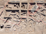
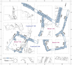
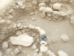
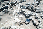
Architectural Remains and Installation. In the eastern part of Area B (Square H19), excavations uncovered walls formed from two faces of fieldstones and joined to form a building corner. Grape pips and olive seeds were uncovered in this corner. To the northeast, a similar wall (Square G18), which may be part of the same building (Fig. 3), was exposed. South of the building’s corner, segments of walls built of a single row of stones (Squares H20, H25) were uncovered; their function is unclear. In Area C, south of the building (Square H21), a double-faced wall was uncovered. The wall was abutted by a layer of gray soil on which two Early Bronze Age IB bowls rested; this may be a habitation level of another building. In the southern part of Area C (Square G26), another double-faced wall was uncovered; this may also be part of a building. In addition, in Area B, excavations discovered two rock-hewn installations delineated by a row of fieldstones (Square E17) and a curved wall, which may be the remnant of an installation or a silo (Square F15).
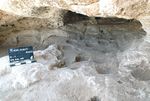
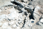
Cave 1 (max. dimensions 10.92 × 13.74 m, height c. 2 m) was quarried into hard limestone bedrock. Its entrance was not discovered, and it was excavated after part of the ceiling was removed with mechanical equipment. The cave’s floor is smoothed bedrock, in which cupmarks and basins for food processing were hewn (Fig. 4). Similar caves with hewn installations were uncovered in Area 1500 at Tel Lakhish, and these were dated to the Early Bronze Age IB (cf. Caves 1523 and 1535; Tufnell 1958: Pl. 3:1, 2, 5).
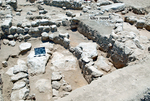
Caves 2 and 3 (Fig. 5). North of the caves, there was a corridor (c. 4 sq m) bounded by fieldstones walls. This northeast–southwest passage connects to a second corridor (c. 13 sq m) that runs perpendicularly along a northwest–southeast axis. The latter corridor is partially hewn into the bedrock and partially enclosed by fieldstone walls, leading north to Cave 2 and south to Cave 3. Excavations in Cave 2 uncovered an anteroom with a channel hewn into its walls, leading to another rectangular cavity. Pottery sherds dating to the Early Bronze Age IB were found in Cave 2.
Cave 5 (max. dimensions 12.86 × 18.18 m). The cave has two entryways: one in the center of its eastern wall and one farther north in its eastern wall (Square G20). The second entryway is oval and leads to the cave through a hewn tunnel passable only by crawling. Finds recovered from this oval opening and the tunnel date predominantly to the Early Bronze Age III (see below), but the initial hewing may date as early as the Early Bronze Age IB. The cave’s floor is smoothed bedrock, into which basins and cupmarks for food processing were hewn. Scattered pottery sherds from the early stage of the Early Bronze Age IB were found inside the cave, south of the central eastern entrance, indicating that this was the cave’s initial use phase. Cave 5 has a layout similar to Cave 1 and the caves found in Area 1500 at Tel Lakhish (see below).
Stratum 2—The Early Bronze Age IB, the Late Stage
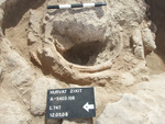
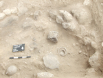
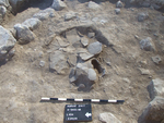
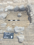
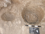
Remains of a building with three architectural phases (Phases 2a–2c) were discovered in Area C (Squares F–G/25–26). It is impossible to determine with certainty if the late phase (Phase 2c) is part of this building or if it represents architectural remains of another building, which was built once the earlier building went out of use. The building’s walls were constructed from two faces of fieldstones. Three spaces were found inside the building: a kitchen (?; Room 1), a storage room (?; Room 2) and a large courtyard (Courtyard 3). The kitchen (c. 7.5 sq m), whose southern and western walls were not exposed, contained a circular ṭabun (Fig. 6), built in a natural depression in the bedrock and delineated by a row of bricks. It was covered by a thick layer of white material (lime?) that blocked it. In the storage room, there are two small segments of a plaster floor and an ash layer. Twenty-five bowls, most of them intact, and a few storage vessels (Fig. 7) were uncovered in the ash layer. In the courtyard (c. 45 sq m), a circular silo was exposed (Fig. 8). It was abutted by stone paving, which was uncovered only in the western part of the courtyard. The silo and the paving were attributed to Phase 2a, the early phase of the stratum. During Phase 2b, the courtyard was reduced in size by half through the construction of an eastern boundary wall. The courtyard paving remained in use during this phase. Within the Phase 2b silo, two pithoi and three complete jars that were used to store agricultural produce (Fig. 9) were found. The architectural remains of Phase 2c are double-faced walls that form a corner. They were built over the remains of Phase 2b and bounded the ṭabun on the east. No habitation level associated with these walls was found during the excavation.
Stratum 3—The Early Bronze Age III
Three occupation phases in architectural complexes and caves (Phases 3a–3c) were identified in this stratum. During the early Phase 3a, Caves 2–4 were used, showing some continuity from the Early Bronze Age IB (see above). During the later phases (Phases 3b and 3c), four architectural complexes (1–4) were built, Caves 1 and 5 came back into use and Cave 6 was newly used.
Phase 3a
Caves 2 and 3 (Fig. 5). At the beginning of the Early Bronze Age III, Cave 2 and potentially Cave 3 were reoccupied. Pottery dating to this period was found in Cave 2. At some stage, walls were built to block the entrances to the caves and the passages of the corridors leading to them. A sample taken from wood found in a fill that blocked the corridors was radiocarbon dated to the end of the Early Bronze Age II and beginning of the Early Bronze Age III. These caves were seemingly used for only a short period of time.
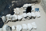
Cave 4. The entrance to the cave was blocked by a collapse of stones (Fig. 10). Three walls built of fieldstones divided the cave into three spaces. Pottery that characterizes household activity was found: bowls, trays, holemouth jars, jars and jugs. The layout of the cave is similar to those of Early Bronze Age III dwelling caves that were uncovered in Ramat Bet Shemesh (Caves B2–B4; Paz and Mizrahi 2023: Figs. 7–8) and Tel Lakhish in Areas 6000 (Caves 6013, 6031; Tufnell 1958:297–299, 303, Fig. 17) and 1500 (Cave 1535; Tufnell 1958:266–277, Pl. 3:2).
A burial of a male and a female individual in their 40s and 50s (respectively) was uncovered in the southern part of the cave. A burnt layer was uncovered underneath the bones, and it may be related to the burial. It is unclear whether the burial dates to the end of Phase 3a or the beginning in Phase 3b, prior to building Complex 1 (see below).
Phases 3b and 3c
Architectural Complexes 1–4 were built in Phase 3b, and they contain rooms and courtyards. The complexes share outer walls, which were built of two rows of hewn stones with a core of soil and stones. The complexes were not fully excavated, and their entrances were not uncovered. In addition to these complexes, architectural remains, which may be related to other complexes, were uncovered. The entrance to Cave 5 was uncovered in the courtyard between Complexes 3 and 4. During Phase 3C, some of the complexes underwent architectural modifications, such as repair of walls and construction of partition walls. Extensive alterations changed the layout of the entire building in Complex 2; the rooms were extended by removing walls between adjacent rooms, the passage to the corridor that led to Cave 6 (see below) was blocked and the cave went out of use.
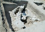
Complex 1 (est. size c. 100 sq m; Fig. 11). The complex was partially exposed. It contains a large rectangular courtyard (Courtyard 1; est. size 60 sq m) and three long rooms (Rooms 2–4) to its north. The courtyard floor was made of tamped earth, and there is a column base in its center, suggesting the courtyard was roofed. A square installation in Room 2 was built of large flat stone slabs that were placed vertically. The southwestern part of the complex was not fully exposed, but according to the reconstruction of the walls, its southwestern corner was likely built above the entrance of Cave 4. Therefore, when the complex was built, the cave went out of use.
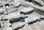
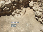
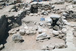
Complex 2 (c. 200 sq m; see Fig. 3). The eastern part of the complex was not completely exposed. Three rooms (Rooms 1, 3, 7) and three courtyards (Courtyards 2, 5, 6) were built in Phase 3b (Fig. 12). A subterranean corridor bounded by two walls and roofed with large stone slabs was hewn in Courtyard 2 (W69, W70; Fig. 13); it led to Cave 6. It is unclear if at this phase there was a room or courtyard above the corridor. Next to the corridor to the north, there was a circular silo (L555), which may be related to activity in the cave during this phase. A stone slab floor was uncovered in Courtyard 5 (Fig. 14).
In Phase 3c (Fig. 15), Room 1 and Courtyard 2 were merged by removing the partition wall between them. Cave 6 and the corridor that led to it were blocked, and above them a rectangular room (Room 4) was built; a ṭabun was found in the room (Fig. 16). Courtyard 5 was extended to the east by removing the wall that separated it from Room 3, which went out of use. The stone slab floor in Courtyard 5 was replaced by a plaster floor (Fig. 14). Courtyard 6 and Room 7 remained in use unchanged.
Complex 3 (est. size c. 150 sq m; see Fig. 3) was partially excavated. Three rooms (Rooms 1, 2, 4) and two roofed courtyards (Rooms 3, 5) were built in it during Phase 3b. Three circular silos were discovered in the courtyards: two in Courtyard 3 (Fig. 17) and one in Courtyard 5. A floor bedding, made of compacted light-colored earth, was uncovered in Courtyard 1 (Fig. 18), and there were three installations on it; two of them are delineated by upright stone slabs, and the third is a stone mortar. A habitation level with a smashed holemouth jar (Fig. 19) was uncovered in Room 2.
During Phase 3c, the wall that separates Rooms 1 and 2 was rebuilt. A partition wall constructed of a row of stones was exposed in Room 2; it enclosed a small rectangular space in the northern part of the room, possibly for storage.
West of the complex, there was another room (Room 6), separated from the complex by an alleyway paved with fieldstone slabs (Fig. 20). The bedrock surface in Room 6 is high, and the floor was not preserved. An intact churn dating to the Early Bronze Age IB (Fig. 21) was found in the room. Its presence in a building dated to the Early Bronze Age III indicates that the original room floor at a higher level that did not preserve.
Complex 4 (est. size 110 sq m). The excavation of this complex was restricted, so the layout is unclear. Two courtyards (Courtyards 1, 4) and a room (Room 3) were built in Phase 3b; Courtyard 4 may be part of another complex that has not been uncovered. In the western part of Courtyard 1, the excavation uncovered remains of benches leaning against the courtyard wall. Room 3 was partially uncovered, and its southern and western walls were not preserved. Basins with a spout, a cooking pot and holemouth jars were found in the room. The size of the room was reduced during Phase 3c, and another room (Room 2) was built in its northern part. An ash layer was found, indicating that the room was used for cooking, was found. Basins and holemouth jars were also uncovered in Room 2.
Cave 1. The hewn basins and cupmarks were again used to produce oil and wine (Fig. 4). The cave may have already come back into use during Phase 3a, but this cannot be ascertained with certainty. The pottery found in the cave dated to the Early Bronze Age III, and most vessels are typical of household activities: bowls, holemouth jars, jars and jugs.
Cave 5. The entrance to the cave passed through a roofed courtyard, which was added between Complexes 3 and 4, where a subterranean corridor bounded by two walls was hewn (Fig. 22). The oval opening from Stratum 1 remained in use during this phase, and the hewn cupmarks and basins were reused. At the base of one cupmark, a channel for draining liquid (Fig. 23) was hewn; this is reminiscent of traditional installations for producing olive oil. A large quantity of storage vessels, including basins with a spout and holemouth jars, was uncovered in the cave, demonstrating that it was used to manufacture and store olive oil and wine. A passage into Cave 6 was uncovered in the northwestern wall of the cave.
Stratum 4
Walls that could not be assigned to the rural settlement of the Early Bronze Age IB and III were uncovered. These may be walls of agricultural terraces like the numerous walls recorded during the Amaẓya survey that are indicative of agricultural activity in the area (Dagan 2006: Site 102). In Area B, a wall built adjacent to the northern and eastern walls of Complex 1 was uncovered; together, they formed a broad wall (c. 2 m thick). The wall was oriented differently than the complex’s walls; therefore, it was likely built later. In Area C (Squares G23–G24), a wall post-dating Complex 4 was exposed; it was built from a row of hewn stones and oriented perpendicular to the complex’s western wall. A double-faced wall constructed from hewn stones (Square E24) and remnants of other walls (Square H21) were also uncovered.
Summary
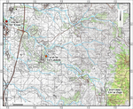
An unfortified village was uncovered at Giv‘at Ziqit. This was part of a settlement network near Naḥal Lakhish during the Early Bronze Age IB (Strata 1 and 2); the center of this network was Tel ‘Erani (Fig. 24). The botanic remains found in Stratum 1, including olive seeds and grape pips, as well as the flint and stone tools and the faunal remains indicate a subsistence economy based on grain, fruit and livestock. Grapes and olives became an important component of the diet during the Early Bronze Age, while wheat was already the primary grain exploited (Zohary, Hopf and Weiss 2013:5, 23). Caves 1, 2 and 5 were used to produce food in Stratum 1 during the early phase of the Early Bronze Age IB. Since little of this stratum was exposed, determining the relationship between the caves and the buildings is difficult. No evidence for reuse of these caves in Stratum 2 was found. Renewal of the settlement during the Early Bronze Age III (Stratum 3) canceled early remains from Strata 1 and 2. In the early phase of Stratum 3 (Phase 3a), finds were uncovered only in the caves, without architectural remains. In the later phases (Phases 3b and 3c), four architectural complexes were exposed. Each complex was comprised of several rooms and courtyards, indicating that they were used by extended rather than nuclear families.
Six subterranean caves were uncovered in the excavation. In this area, using subterranean spaces can be dated as far back as the prehistoric periods (Bar-Yosef and Garfinkel 2008:303–306), and in the Arad Valley and Judean Plain, it was common during the Early Bronze Age I. Examples can be found in Stratum 4 at Tel Arad, where a subterranean space with cupmarks was found underneath a building (Amiran 1978:18), and at Tel Ḥalif in the Early Bronze Age IA (Levy et al. 2001). At Tel Lakhish, from the Chalcolithic period to Early Bronze Age I, there was continued use of subterranean spaces; in Area 1500, agricultural instillations were found in subterranean spaces, similar to the ones found in the excavation of the caves at Giv‘at Ziqit. During the Early Bronze Age III at Giv‘at Ziqit, the subterranean spaces were again used as dwellings or for industry, as was also the case in Areas 1500 and 6000 at Tel Lakhish; some were reused as burial areas (Tuffnell 1958:266–277, 297–300). Similar caves with agricultural installations, dating to the Early Bronze Age IB and Early Bronze Age III, were uncovered near Tel Yarmut (Haber 2017; Paz et al. 2017; Paz and Mizrahi 2023). The rural settlement from the Early Bronze Age III at Giv‘at Ziqit is unique because it is the only settlement where subterranean spaces were found underneath residential buildings.
Cupmarks were commonly used for olive oil production in rural areas during the Early Bronze Age (Sabatni 2019). Cave 5 is a clear example; excavations uncovered a cupmark with a hewn drainage channel at its bottom (see Fig. 23), which is reminiscent of traditional installations for extracting olive oil. Additional supporting evidence is the pottery from the cave, which includes numerous holemouth jars and jars and six basins with a spout; these indicate that the cave was used for producing and storing olive oil and wine. North of the excavation area, other caves were previously exposed (Permit No. A-3077), and at the end of the current excavation, another cave was found and only documented. Therefore, there are likely other caves on Giv‘at Ziqit, which have not been found yet.
References
Amiran R. 1978. Early Arad I: The Chalcolithic Settlement and Early Bronze City. First–Fifth Seasons of Excavations, 1962–1966 (Judean Desert Studies). Jerusalem.
Bar-Yosef O. and Garfinkel Y. 2008. Prehistory of Israel: Human Cultures Before Writing. Jerusalem (Hebrew).
Dagan Y. 2006. Map of Amaẓya (109). The Southern Sector (Archaeological Survey of Israel) Jerusalem.
Haber M. 2017. Bet Shemesh, Ramat Bet Shemesh Neighborhood D2 (A). HA–ESI 129. https://doi.org/10.69704/jhaesi.116.2004.25255
Levy T.E., Alon D., Brink E.C.M. van den, Kansa E.C. and Yekutieli Y. 2001. The Protodynastic/Dynasty 1 Egyptian Presence in Southern Canaan: A Preliminary Report on the 1994 Excavations at Nahal Tillah, Israel. In S.R. Wolff ed. Studies in the Archaeology of Israel and Neighboring Lands in Memory of Douglas L. Esse (Studies in Ancient Oriental Civilization 59 and ASOR 5). Chicago and Atlanta. Pp. 411–446.
Levy-Reifer A. 2004. The Settlement in the Judean Shephelah during the Early Bronze Age in Light of the Archaeological Excavations and Surveys. Ph.D Diss. Bar-Ilan University. Ramat Gan (Hebrew).
Paz Y., Akerman O., Avni Y., Ben-Hur M., Birkenfeld M., Langgut D., Mizrahi A.S., Weiss E. and Porat N. 2017. An Early Bronze Age Fertilized Agricultural Plot Discovered Near Tel Yarmouth, Ramat Bet Shemesh, Israel. JAS Reports 15:226–234. https://doi.org/10.1016/j.jasrep.2017.08.001
Paz Y. and Mizrahi A.S. 2023. Subterranean Spaces Outside Tel Yarmouth—Evidence of Early EB IB Burials, EB III Dwellings and Agricultural Activities. In O. Sion, O. Shalev, B. Storchen and Y. Zlinger eds. Along the Road to Beit Shamash (I Samuel 6:12): Archeological Studies of the Ramat Bet Shemesh Region. Jerusalem. Pp. 49–86. https://doi.org/10.2307/jj.9941115.8
Sabatni S. 2019. Olive Oil in Southern Levant: Rise and Fall of an Economy in The Early Bronze Age. In E. Gallo ed. Conceptualizing Urban Experiences: Tell es-Sultan and Tall al-Ḥammām Early Bronze Cities across the Jordan (Studies on the Archaeology of Palestine and Transjordan 13). Rome. Pp. 247–263.
Tufnell O. 1958. Lachish (Tell ed-Duweir) IV: The Bronze Age (The Wellcome Archaeological Research Expedition to the Near East Publications IV) (2 vols.). London–New York–Toronto.
Yekutieli Y. 2000. Early Bronze Age I Pottery in Southwestern Canaan. In G. Philip and D. Baird eds. Ceramics and Change in the Early Bronze Age of the Southern Levant (Levantine Archaeology 2). Sheffield. Pp. 129–152.
Yekutieli Y. 2006. The Ceramics of Tel ‘Erani, Layer C. Journal of the Serbian Archaeological Society 22:225–242.
Zohary D., Hopf M. and Weiss E. 2013. Domestication of Plants in the Old World: The Origin and Spread of Domesticated Plants in Southwest Asia, Europe, and the Mediterranean Basin. Oxford. https://doi.org/10.1093/acprof:osobl/9780199549061.001.0001
Keywords
Shekef, Lachish Valley, Early Bronze Age, rural settlement, architectural complexes, caves, subterranean spaces, olive oil production, wine production, agricultural installations, burial
Publication Date
13/10/2026
Report Type
Preliminary Report